We are turning a blind eye to the facts that most of our major water resources projects are suited for multipurpose development. Thanks to it they are attractive. The generation cost of electricity from such projects would be comparatively low. It is not difficult to observe that apart from energy generation, the rational utilization of Nepal’s water resources potential could also be helpful to a certain extent in resolving simultaneously the present time Terai political controversy.
Unfortunately our policy makers, planners and intelligentsia are seen tobe completely unaware about the critically important role water resources could play in overcoming the great difficulties faced by our country.Moreover, instead of rationally utilizing ourprecious water resources, wherever possibleby tapping its full potential to provide simultaneously energy, irrigation, flood control, navigation etc benefits, which would have been clearly in the interest of our country, very recently our country is virtually embarked on a path to ruin it. The examples are launching of the Dudh-Kosi and Lower Arun projects by substantially reducing the potential of Kosi and Sun-Kosi projects. Similarly the implementation of the 900 MW Upper Karnali project killing perhaps the world’s one of the most attractive 4800 MW Upper Karnali storage project.
Parching Lands and Floods
Our Terai is primarily a agricultural region of our country. According to innumerable studies, the future economic sustainability of our Terai is very much dependent on mid hill regions for replenishment of water supply from the existing water sources, which are already gradually drying up.
On top of the above explained dependency, the 2008 Kosi flood disaster has amply demonstrated that in future the Kosi region would be faced with far greater flood disasters, as forecasted by renowned experts. Even thephysical existence of some region of our Terai and also north-east Bihar might be depending on comprehensiveflood control planning of water resource in hill region sacrificing significant electricity generation potential.
Depletion of Surface Water
The water resources of Terai is being depleted due to the main following reasons:
(1)There was a rampant deforestation in the past across the entire Terai region and its adjoining Churia area. This has led to gradual drying up of the local rivulets and streams that were traditionally the source of local irrigation. Contrary to it, area under cultivation has greatly increased due to deforestation, which has led to increase in demand for water needed to irrigate new lands.
(2)There is a rapid growth of population in the upper catchment areas of small and medium sized rivers directly flowing into Terai from the hill areas. The flow of these rivers is being increasingly used in the hill region itself during the dry season since a long time with the result that the dry season flow of such rivers in Terai is constantly decreasing.
(3)Greater use of ground water in Bihar, which is our lower riparian, would lead to substantial depletion of ground water potential of our Terai in future. Ground water dispute between Mississippi and Tennessee clearly explains that the upper riparian at disadvantage to lower riparian in respect of exploitation of ground water resources. Cone of depression formed due to pumping of ground water by Tennessee had led to depletion of ground water resources of a large area of Mississippi, which is at higher elevation.
UNDP/FAO Studies
Since 1960s several detailed studies have been conducted to recommend ways to resolve water supply to irrigate on a large scale Terai lands. These studies were conducted by UNDP/FAO for area between Parsa and Saptari (by diverting Sun-Kosi river); West German Govt. and ADB for Jhapa; Rupandahi and Nawal Parasi by UNDP (by diverting Kali Gandaki river); Kapilvastu and Banke by West German agency (by diverting West Rapti river); Bardia, Kailali by ADB, JICA and World Bank (by diverting Bheri river along with irrigation drawing directly from the Karnali storage dam project). With the exception of irrigation in Jhapa and irrigation drawing water directly from the Karnali storage dam project, all other proposed schemes involve diversion of water from the mid hill by long tunneling across high mountains.
Imminent Kosi Floods
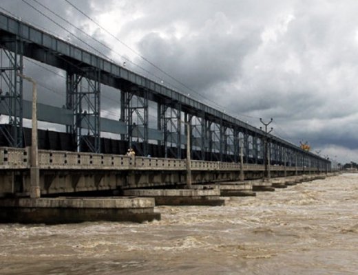
All rivers flowing from hills are liable to flooding in Terai resulting in some cases great losses. Kosi flood losses of all such cases acquire international significance because of the enormity of past and even greater future losses of life and property.
Kosi river known as the sorrow of Bihar in the past had shifted from east to west over 70 miles within a period of 200 years. The shifting of the river course was accompanied by big loss of life and property. However, the embankments built about 50 years ago has come as a great relief by preventing lateral shifting of the river course.
At present Kosi river channel bed is well above the surrounding grounds due to continued siltation. The embankment have already outlived their useful life. We have already witnessed enormous loss of life and property in 2008 breach of Kosi embankment when the flood discharge was only about 1 ½ lack cusecs, where-as extremely high flood discharge of almost nine lacks cusecs have already been measured twice within a time interval of 10 years about forty years ago when river bed siltation had just started. After that the maximum flood discharge was only around 5 lacks cusecs.
Sunsari and Morang Permanently under Water
Well recognized expert on Kosi Sir Claude Inglis and many other similar renowned experts have predicted that during the extremely high flood the Kosi would break away from its present course right away near Chatra breaching the eastern embankment. The Kosi would permanently change its course. A vast area of Sunsari and Morang would become new Kosi river bed, which could be initially ten to twenty kilometers wide.
It is known from the experience of China that apart from permanent change of river course, the loss of life and property would be catastrophic if the river flowing on highly elevated bed spills across the embankment at the time of extremely high flood discharge. It is reported that the loss of life of people alone each time exceeded one million when the embankments of Yellow river, which has almost the same maximum discharge as the Kosi, were breached during very high floods of 18 87 and 1931.
Sacrifice of Mid Hill Interest
It is necessary to implement Sun-Kosi and Kosi storage dam projects to save the life and property of millions living in Sunsari and Morang districts of our country and also north-east Bihar.This calls for great sacrifice of the people living in hill areas of our country.
Nepal’s water resources development planning inclusive of tunneling to divert water to irrigate land in Terai will be more costly and at the same time the power generation potential will also be reduced by comparison to alternative variant earmarked exclusively for power generation. Provision of large storage dam necessary for flood control in Terai will have devastating economic as well as environmental consequences for the people of mid hill. Just in one single Karnali Chisapani storage project case, the land area under submergence will exceed 40,000 hectares.
Consequences of Inter States Rivalry
Inappropriate delineation of our country’s provincial boundaries could hamper water resources development. In our Indian Sub-continent conflict among the states of country have greatly hampered development of water resources. India was easily able to resolve international water disputes over Indus and Ganges with Pakistan and Bangladesh respectively but conflicts among its states still remain fully unresolved. The well known cases of such conflict among Indian states are related to Godavari, Cauvery, Krishna and Narmada rivers.
In Conclusion
Unfortunately our recent governments have failed to explain general public that it would be the greatest injustice to the people of Terai if the mid hill is detached from the Terai region in future restructuring of the provincial boundaries, which would prompt to advancing water resources development projects to maximize benefits accruing exclusively to mid hill region totally disregarding the interest of the Terai.

Dr. A.B. Thapa
Thapa writes on water resources issue
- Dudhkosi Multipurpose Project
- Jul 11, 2022
- Dudh-Kosi Power Project And Kosi Treaty
- Sep 27, 2021
- Uttarakhand Glaciers And Recent Disaster: A Lesson To Our Country
- Mar 02, 2021
- Multipurpose Langtang After Melamchi: Inter-Basin Water Transfer
- Nov 04, 2020
- Large Storage Dams Projects Wary of Giving Away Children’s Inheritance
- Dec 22, 2019