Geologists have predicted that a big earthquake (around magnitude of 8 in the Richter scale) will hit Nepal every 75 years. Some 78 years have passed since a big earthquake hit the country. So, a major earthquake might be looming around the corner as we are already late according to the clock.
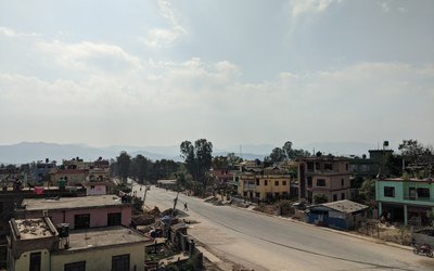
In Nepal, the most significant damage is supposed to be caused to Kathmandu valley where many reports have predicted there will be more than 200,000 casualties if a big earthquake hits the valley. And many of those casualties will be caused by the lack of prompt rescue.
Are we prepared when a major earthquake hits Kathmandu? The city is unplanned, haphazard construction of buildings are already completed and there are not many open places.
Nobody can stop natural disasters like earthquakes but we can definitely do something when it comes to preparing for the disaster. But seriously, what can we do individually apart from being afraid of the future as most of things are already done? The World Bank’s Open Data for Resilience Initiative (OpenDRI) is working on another idea.
Map the City
It is said that even in most difficult of circumstances, damage can be limited if we have proper knowledge of the situation.
OpenDRI Nepal is supporting OpenStreetMap community to create open data on existing asset infrastructure such as road network, schools, health facilities, public buildings of the Kathmandu valley. The data can be used to analyze and prepare for an earthquake when it ultimately strikes. The data will facilitate a seismic risk assessment to produce quantitative loss data that informs future disaster risk reduction activities.
“OpenStreetMap (www.openstreetmap.org) works on crowdsourced model, in which a large number of digital volunteers contribute data about the places they know. The idea is that when we aggregate small contributions from many individuals, we get a rich dataset. Hence, no single individual or institution collects this data”,said Nama Raj Budhathoki, one of the OpenStreetMap enthusiasts who now leads OpenDRI Nepal project.
As OpenStreetMap uses open source platform, the data collected will be open to everyone and anyone can freely use and download the data.
OpenDRI Nepal team, with the help of many independent volunteers, have already mapped many places within the Kathmandu Valley. Along the side, Nepal’s OpenStreetMap community is also growing everyday. As a result, major point of interests (POIs) like shopping malls, restaurants, temples, schools, hospitals along with the footprints of buildings within the Kathmandu valley have already been mapped.
It is said that local people have the most knowledge when it comes to local places. OpenDRI team is also trying to mobilize the local people. Everyone can contribute to the process who have access to the current technologies like internet and computer or mobile devices. All they need to do is log on to OpenStreetMap website and map their surrounding places.
“If you compare Kathmandu between now and some 4 months ago, you will notice huge difference. A lot of mapping has been done over the last few months, especially after The World Bank’s open data for resilience initiative. The best way for people to contribute to this civic project is to map their surroundings. Those who cannot map will still be able to contribute just by using the map others have created”,said Budhathoki.
Open Data Day
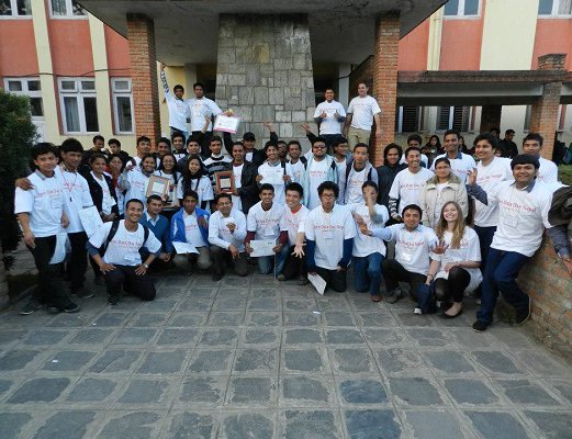
OpenDRI Nepal co-organized the International Open Data Day On February 23, 2013 for the first time in Nepal. In the event which saw an encouraging participation of the enthusiasts of open data, the importance of open data were highlighted and on-going open data projects showcased.
On the Open Data Day, OpenDRI organized a fun event called Mapathon (i.e. map in a marathon style), in which some more than 40 students from Kathmandu University, Institute of Engineering, Nepal Engineering College, and Amrit Science College took part in mapping for 4 hours. They contributed to create an open map data using open source software. They also participated in a geo-cashing treasure hunt. Those activities were complimented by international mappers from around the globe, see this for example.

Debesh Adhikari
Adhikari is a computer science student and writes on various contemporary issues.
- The UK Expressed Deep Concerned About Tensions in Nepal
- Mar 09, 2017
- Development Partners and Ministry of Education Agree to drive quality education
- Sep 28, 2016
- END HUNGERNepal plans to end hunger by 2025
- Mar 14, 2016
- UK Hopes For Inclusive Resolution For Nepal
- Sep 17, 2015
- Micromax Launches Bolt D320 For Nepali Market
- Aug 07, 2015