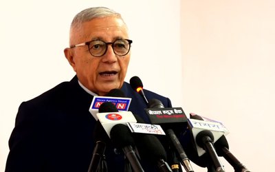
International Workshop on land professionals and Spatial Data Infrastructure in Disaster Risk Reduction in the Context of Post 2015 Nepal Earthquake concluded. The three day conference also passed the Resolutions urging to use spatial data infrastructures in disaster risk reduction.
According to a press release issued by the Workshop, the resolution said having received presentations during this three days’ International workshop from various national and international experts within the various themes ranging from Spatial planning, SDI development, Responding disaster, Geospatial technology, Professional development, Land administration and management and also having intensive discussion within the mentioned themes, the outcome of the workshop bind into the concrete resolutions which are recommended as the following:
“There is an emphasis on the importance of land issues to be incorporated in disaster risk reduction. Land is an essential asset that directly supports physical development, social, economic and environmental management. When disaster occurs, there are direct consequences on the physical, social, economic and environmental aspects. Therefore, proper land use plan, as a pre disaster precaution as well as post disaster action is necessary for secured settlement to fulfill the norms of “Build Back Better”, said resolution.
According to a resolution, proper land management activities like appropriate land allocation, land readjustment and security of land tenure are very important for rescue, rehabilitation and reconstruction in post disaster setting. Therefore, the workshop recommends the Government to formulate, enact and implement a comprehensive land use policy which specifically addresses these issues.
“The governance issues are prominent in responding disaster. The lack/weakness of policies and institutional arrangements like overlaps/duplication of responsibility are key hurdles on humanitarian response during a disaster as well as its aftermath. It is often experienced and seen that the policies are rarely implemented effectively and cooperation among the stakeholders is weak. Therefore, there is a recommendation to design a multi-stakeholder and action oriented framework adopting international land governance framework such as land governance assessment framework developed by World Bank which ensures clear and crisp action points, clear and shared responsibility among various stakeholders, implementation time line and monitoring system,” said a press release.
The intervention towards vulnerable groups from land perspective is mandatory. The legally, socially or economically disadvantaged groups of people are most vulnerable to disaster leading them towards legally, socially or economically less resilience groups. Therefore, the land administration system should be pro-poor, gender friendly and responsive to marginalized group of people in the society who are vulnerable to disaster.
In this context, the workshop recommends the government to adopt the concept of fit-for-purpose land administration and several other tools like Social Tenure Domain Model (STDM), approaches like continuum of land rights and Gender Evaluation Criteria (GEC) developed by Global Land Tool Network (GLTN). These tools can be incorporated in a wider framework suggested by the Voluntary Guidelines on Governance of Tenure for land, forest and fisheries: in the context of national food security (VGGT) proposed by FAO.
The importance of Geospatial data in the pre disaster and post disaster is highlighted predominantly. Spatial data on the availability of open spaces for rescue and temporary shelters, identification of appropriate land for safe and secure resettlement of the victim, land use data, vulnerability and risk maps, relocation and readjustment of land for the buildings and other infrastructure are needed for post disaster rehabilitation and reconstruction. The fundamental base of geospatial data, the national geodetic datum has been destroyed due to the devastating earthquake. So, it is essential to reestablish and strengthen the datum with modern 4 dimensional dynamic datum with a network of active CORS stations that can also be useful in studies of seismic activities.
There are several geospatial techniques in positioning, navigation and measurement that may help in prediction and forecasting trends of the disaster, its frequency and potential damages. Various approaches such as Open Street Mapping (OSM) and Crowd sourcing can be adopted for rapid acquisition of geoinformation in pre and post disaster scenario. Therefore, the workshop recommends adopting appropriate tools and techniques for accurate and timely geoinformation acquisition, processing, visualization and dissemination. It further recommends strengthening Spatial Data Infrastructure (SDI) techniques to facilitate effective and efficient data sharing and use.
Capacity development is another most important issue to deal with. There is an urgent need of professionals who can work in pre and post disaster settings. Awareness raising and preparedness are the pre disaster activities and quick response, rescue, and relief in short term and rehabilitation and reconstruction are the post disaster actions to be carried out. Land professionals are on high demand to respond disasters in various phases of disaster cycle.
Therefore the workshop suggests the Government to carry out capacity building activities such as academic studies and research, skill enhancing activities, project works and tutorials, experience sharing events such as workshops, seminars, exhibition for continuous professional development of the professions to support DRR in long term.
Finally, this workshop is at the end with a great success. It is able to deliver the clear message on role of land professionals and SDI in DRR. This great success is only observed because of the outstanding contribution from various stakeholders. Furthermore, incredible support from various government organizations, non-government organizations and private sector associated with land, disaster and Geospatial industries as well as other user community have made this event a great success. Hence, the workshop offers its sincere acknowledgement and gratitude to all concerned for their incredible and valued contribution in the grand success of this workshop.
- NEPAL-THAILAND: Joint Business Council
- Apr 13, 2025
- BIMSTEC SUMMIT: Nepal’s Stand
- Apr 11, 2025
- IME GROUP: Expands Into Paper Industry
- Mar 24, 2025
- CPN UML: Instigated By India
- Mar 23, 2025
- ADB’S CHIEF ECONOMIST: Nepal Reduces Poverty
- Mar 11, 2025
