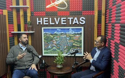
Could you please explain the Nagmati project as there are people who are against its construction?
The Bagmati River Basin (BRB) holds great cultural and economic importance. The water that flows through the Bagmati River is considered sacred and is utilized for various cultural and ceremonial practices in the numerous significant temples situated along its banks. This river passes through Kathmandu, which serves as the administrative and economic hub of the country and acts as Nepal's gateway to tourism.
Unfortunately, the Bagmati River and its tributaries suffer from poor water quality due to the discharge of untreated or inadequately treated domestic sewage, untreated industrial effluent, and the dumping of solid waste, all of which contribute to the degradation of the river system. The scarcity of water, absence of sewage treatment plants, and the dumping of solid waste have led to a significant decline in water quality. Additionally, the deterioration of cultural and heritage sites is a growing concern.
To address these issues, the Bagmati River Basin Plan was developed by WECS, and the Water Resources Development Plan estimated the future water demand based on population growth projections. However, solely relying on the Melamchi project is insufficient to bridge the gap between water demand and supply in the Kathmandu Valley. Therefore, the BRB project has explored alternative water resource development projects based on different scenarios. It is worth noting that the groundwater level around the Bagmati River is progressively decreasing year after year.
Therefore, the only option available to save the Bagmati River is a reservoir that will retain the excess wet season runoff for release during the dry season. A detailed assessment was carried out to determine the required storage of the new reservoirs to achieve the perennial flow and water quality targets at Gokarna and Pashupatinath, at least bathing standard.
What are the benefits of the Nagmati Dam in terms of increasing the volume of water in Kathmandu?
The Nagmati Dam Project (NDP) consists of a CFRD with a height of 94.5m, length of 554m and crest width of 7m. The construction of the dam will create a reservoir expanded in an area of 480,426 m2 at FSL with a storage capacity of 9,484 Mm3 at FSL. The regulated water flow of 450 LPS will be used for augmentation of dry season flow of Bagmati. Thus, the increased volume of water will be used for:
- Improving the water clarity, odor and visual cleanliness of the river;
- Maintaining water quality at Gokarna and Pashupatinath religious sites with minimum flow of 0.45 m3/s throughout the year.
- Maintain a minimum flow throughout the year based on the ecological environmental flow requirement of the Bagmati River;
- Increase the benefits of the project by generating hydropower from the diverted discharge into the Bagmati River at Sundarijal;
- Provide additional potable water to Kathmandu Upatyaka Khane Pani Limited through the Melamchi Water Supply Project during the monsoon season; and
- Contribute to the groundwater recharge of Kathmandu.
Are there any alternatives?
An alternative to dam construction on the Nagmati or Bagmati rivers is inter-basin transfer from another river system. Considering the time required to plan, design and implement an inter-basin transfer, the most favorable option would be to use water from the Malamchi Tunnel, if possible.
The Malamchi Project involves the construction of an approximately 27 km long diversion tunnel to divert 170 MLD of raw water from the Melamchi River to the Sundarijal Outfall, where the raw water will be treated. As the first phase of the WWTP project, the detailed design of the WWTP capacity was completed for 170 MLD with provision for future expansion. The plant will be developed in three phases of 170 MLD each to achieve a final WWTP capacity of 510 MLD. However, the water demand forecast by KUKL showed a daily demand of more than 800 MLD for the Kathmandu Valley. Even if the 3 phases of the Melamchi project are completed on time, a significant gap will remain. Since the water scarcity in the Kathmandu Valley will persist even after Melamchi becomes operational, the likely scenario is that no water will be available to augment the low flow in the Bagmati River during the dry season. Therefore, the inter-basin transfer alternative was not considered feasible in any foreseeable future.
If the project is so important, why has it taken so long to start construction?
The EIA report was prepared and submitted for approval to the then Ministry of Population and Environment in 2015. This report was prepared and updated in accordance with the newly promulgated EPA, 2076 BS and EPR, 2077 BS incorporating necessary comments/suggestions received from Shivapuri National Park, DNPWC and Ministry of Forests and Environment by the consultant on behalf of the project proponent.
A feasibility study on the proposed Nagmati Dam was carried out by the Danish Hydraulic Institute (DHI) in 2012-2013. This was undertaken as an Asian Development Bank (ADB) technical assistance project, TA 8050. The water balance modeling for the Bagmati River Basin undertaken by this study assessed the required release from the Nagmati Dam. An extended study was conducted by Entura for the NDP in 2016. Due to the sensitivity of the dam, the project has to conduct a detailed study regarding the safety of the dam, as it is located in the Shivapuri National Park, it also took considerable time to proceed with the EIA report.
The civilization of the Kathmandu Valley is closely linked to the water of the Bagmati River. Can you provide information on the current flow of water in the river?
During the dry season, the entire flow of the upper Bagmati River is diverted for domestic use, leaving no flow for the downstream river environment. The Bagmati River has become a "dead river" due to severe water scarcity in the dry season and lack of wastewater treatment facilities. Water scarcity, lack of wastewater treatment plant and solid waste dumping have caused severe degradation of water quality, deterioration of cultural and heritage site.
For water resources development, future water demand was estimated based on population growth projections. Melamchi alone is not sufficient to bridge the gap between water demand and supply in the Kathmandu Valley. Groundwater in the vicinity of the Bagmati River is also declining at an alarming rate.
Upstream watershed degradation is also contributing to the decline in river flow and groundwater recharge. Declining water levels are observed in most of the monitored wells. The northern groundwater district has the maximum decline of 1.7 m/yr. The southern groundwater district has the lowest decline of 0.7 m/yr. However, this is likely to change in the near future as many large housing complexes are planned in the south.
Given that the flow of water in the Bagmati River is virtually non-existent for eight months during the dry season, which adversely affects cultural and religious activities, what measures can be taken to increase the volume of water in the Bagmati River?
The Bagmati River consists of several temples, cultural site, and crematorium along the banks. The culture and civilization of Kathmandu valley is connected with Bagmati River. It is a holy river. So purification of Bagmati, augmentation of water to minimum requirement as mentioned earlier is an urgent requirement. For this, there are no significant measures except collecting water of the rainy season and releasing it in the dry season. The Melamchi diversion will only be for domestic water supply as discussed earlier.
Given that the Kathmandu Valley is experiencing rapid population growth and is an unplanned city, how challenging is it to effectively manage the three main rivers that sustain life in the area?
River management in the Kathmandu Valley is indeed a major challenge due to several factors including population growth, unplanned settlements and urbanization. As the population grows, so does the demand for land, housing and infrastructure, often resulting in encroachment on riverbanks and floodplains. Improper waste disposal, industrial effluents and untreated sewage discharge contribute to water pollution, affecting both the environment and public health. River management in the Kathmandu Valley is often hampered by a lack of integrated planning and coordination among different stakeholders, including government agencies, local authorities, and communities. Fragmented governance structures and conflicting priorities can impede effective river management efforts. Addressing these challenges requires a holistic approach that integrates land use planning, infrastructure development, environmental protection, community engagement, and sustainable water management practices, which is what the Bagmati Action Plan is implementing.
What is the current status of the Bagmati River Integrated Project?
Bagmati River Basin Improvement Project (BRBIP) is under the Ministry of Urban Development and WE, MoEWRI/DWRI, are only the implementers of Output 3 of the project which is limited to construction of dams in Shivapuri/Nagarjun area. However, the major achievements so far are 1) completion of Dhap dam and preparation of Nagmati dam, 2) completion of Bagmati river beautification works (package 1), 3) revival of old monuments, temples along the river corridor. 4) Construction of sewage treatment plants (ongoing at Teku), 5) Master plan based approach to cover all tributaries of Bagmati in Kathmandu valley.

What is the status of the Nagmati Project after the successful construction of the Dhap Dam, which has helped to raise the water level of the Bagmati River to some extent?
The Nagmati project is in the preparation stage. The Nagmati Dam Office has been established at DoWRI, Jawalakhel. EIA approval process is underway (now in MoFE for final approval). Land acquisition process is underway. The donor agency, ADB, has also prepared for loan management.
What is the significance of the Nagmati Dam project for augmenting the water level of the Bagmati River?
Nagmati will store about 9 Mm3 of water in a year and can flow 450 lsp on a regular basis. This is almost twice the flow of the Bagmati River in the dry season. It will also contribute significantly to groundwater recharge. This project will not only provide water to the river, but will also generate power and supply to the Melamchi system during emergency maintenance or even during the monsoon season when the flow of the Melamchi River is uncertain. Three ministries have signed a memorandum of understanding for the integrated use of water released from the Nagmati dam.
Although some groups are lobbying against the project due to concerns about the risky nature of the dam, what is the technical justification for the project?
Dam failure can be catastrophic. Due to the location of an intense seismic zone, a large settlement and a very important religious and cultural site downstream along the river bank, its depth of study, safety parameters and robust design are primary requirements and need serious attention. This has been well and adequately considered during project preparation of Nagmati dam project. A site-specific seismic hazard assessment has been carried out for the Nagmati Dam site; Based on ICOLD Bulletin 72 (ICOLD, 2010b), the following applies to dams in the Extreme category
Operating Basis Earthquake (OBE): this is a level of shaking at which there should be no or insignificant damage to the dam and associated structures.
Safety Evaluation Earthquake (SEE): This is a level of shaking for which damage can be accepted, but there should be no uncontrolled release of water from the reservoir.
SEE is the maximum magnitude of earthquake for which the dam should be designed (Note: SEE replaces MCE (Maximum Credible Earthquake) and DBE (Design Basic Earthquake) terminology used in previous editions of ICOLD Bulletins prior to 2010).
A site-specific seismic hazard assessment was conducted for the Nagmati Dam site. Entura prepared the scope for the seismic hazard assessment study and through a competitive. Seismic Research Centre (SRC) of Australia to undertake the study. This was undertaken using both a deterministic and probabilistic approach. This study formed the basis of the seismic design loads adopted for the project.
Will the Nagmati Dam submerge all settlements, including Pashupatinath, in the event of a dam failure?
The safety requirement against seismic, geotechnical and hydrological hazard analysis has been done based on the well tested highest standard of safety. Likewise structural component of the dam has been designed so that such event will not happen and mentioned submergence will not happen in the mentioned extent.
Considering Nepal's location in a seismic zone, how resilient is the dam from technical point of view?
As a dam of extreme consequence category (ANCOLD, 2012), the highest standards of dam design have been adopted. Given the high seismicity of the site, a defensive seismic design has been adopted to ensure that the dam is resilient.
- Pakistani Embassy In Kathmandu Hosted A Reception On 85th National Day
- Apr 16, 2025
- Earthquake Rocks Kathmandu Valley
- Apr 16, 2025
- Prof Dr Khadga KC assigned responsibility of TU Vice Chancellor
- Apr 16, 2025
- Weather Forecast: Partly Cloudy With Brief Rain In Kathmandu, Surkhet And Pokhara
- Apr 16, 2025
- Continuous Earthquake Tremors In Jajarkot
- Apr 15, 2025


